Uttarakhand glacier burst: ISRO releases first images of damage at Raini, Tapovan
The Indian Space Research Organisation (ISRO) has released the first images of the Uttarakhand glacier burst that has so far claimed 32 lives, while more than a hundred people remain missing.
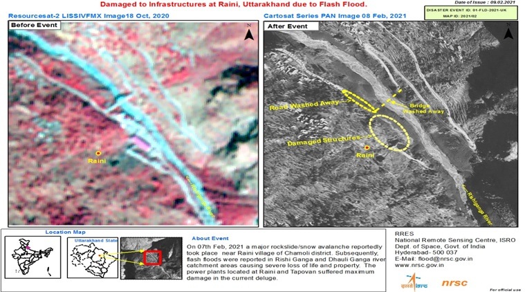
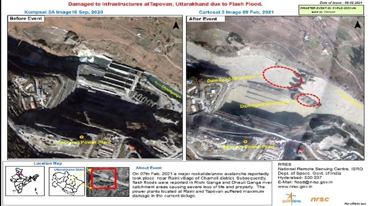
As per the satellite images, the flash floods — reported in Rishi Ganga and Dhauli Ganga river catchment areas — as a result of a major snow avalanche near Raini village of Chamoli district, has caused severe loss of life and property. The power plants located at Raini and Tapovan suffered the maximum damage in the deluge.
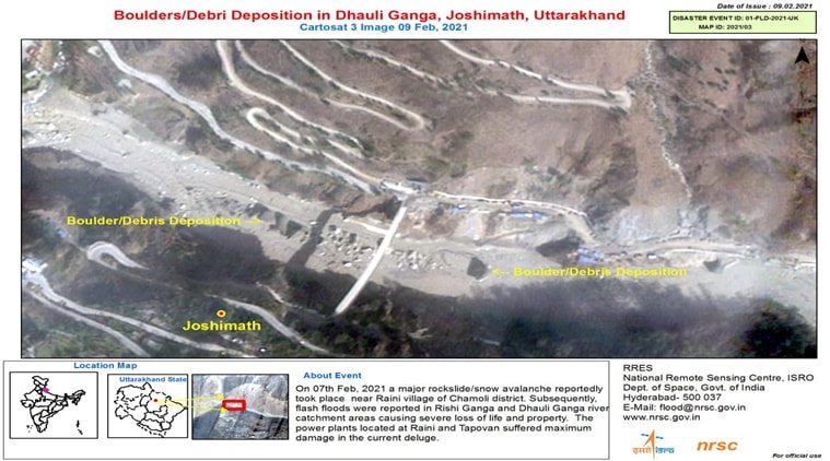
While one of the satellite images show massive debris deposition in Dhauli Ganga, other images have displayed damage that have occurred at dam infrastructures at Tapovan and Raini due to the flash floods.


The images were captured by the space agency’s advanced earth imaging and mapping satellite CARTOSAT-3.

CARTOSAT-3 is a third-generation agile satellite with high-resolution imaging capabilities.
The images have emerged as multi-agency relief operations continue in Chamoli and adjoining areas of Uttarakhand. A DRDO team is working along with ISRO scientists and experts to ascertain the cause of the tragedy.
Rescue efforts by multi-agency security personnel were intensified on Wednesday with the help of drones and remote-sensing equipment to locate those trapped inside the Tapovan tunnel, which is chock-a-block with tonnes of debris.
Meanwhile, scientists are investigating what caused the glacier to break — possibly an avalanche or a release of accumulated water. Experts say climate change may be to blame since warming temperatures are shrinking glaciers and making them unstable worldwide.
What is known is that a portion of the Nanda Devi glacier possibly burst through its banks at Joshimath, triggering an avalanche and a deluge that rippled through the Alaknanda river system in the upper reaches of the Himalayas on Sunday. It swept away a small hydroelectric project and damaged a bigger one downstream on the Dhauli Ganga.


